It was 318 years ago today when the earth last served Northwesterners a catastrophic reminder that it is always in motion.
On Jan. 26, 1700, the Cascadia subduction zone produced a Magnitude 9 megathrust earthquake that ripped a 1,000 km tear just off the North American coast, shaking and flooding land from British Columbia to California.
Oral traditions from the Quileute and Hoh tribes described the night the Thunderbird and Whale fought, shaking mountains, uprooting trees and covering the land with ocean water.
Geologists say the event was the result of the Juan de Fuca tectonic plate pushing under the larger North American plate. The violent subduction resulted in the quake that dropped the coast as much as 6 feet and produced a tsunami that reached almost 1,000 feet inland.
But it was the Cascadia quake’s impacts some 4,700 miles across the Pacific Ocean that allowed scientists to properly date and time the geologic event to around 9 p.m. Jan. 26, 1700.
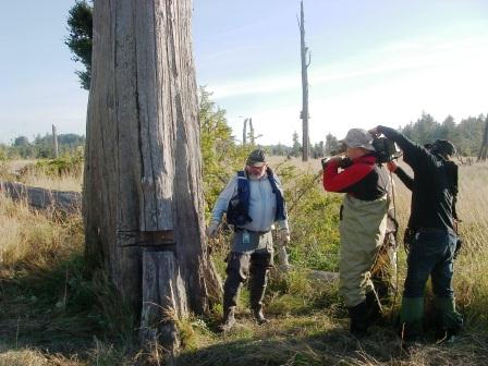
Records in Japan told of the Orphan Tsunami of 1700. That documented tsunami, combined with analysis of red cedar trunks by scientists like Brian Atwater of the United States Geologic Survey revealed land subsidence and seawater inundation that submerged coastal forests.
What about the next one?
So that’s how we know the damage produced by the last Cascadia quake. But what about the next one? The geologic record shows the Cascadia subduction zone produces megathrust quakes every 300 to 600 years, after all.
 The first tip is to be ready. Have plans for what to do when earthquakes or tsunamis happen.
In addition to developing plans to prepare for natural disasters like our friends at Washington Emergency Management advise, you can know more about what these geologic hazards likely mean for your neighborhood, thanks to the hard work of our geologists.
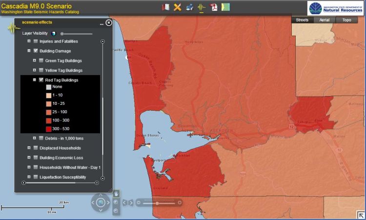
DNR holds scenarios developed to show how seismic forces could impact all of Washington’s communities, from Aberdeen to Zillah. One of those scenarios shows the toll another Magnitude 9 Cascadia quake could inflict.
Shades of red indicate the number of buildings that could be damaged in the Grays Harbor area from another M9 Cascadia subduction zone earthquake.
You can view that scenario, and 19 others on our seismic hazard catalog.
More work to do
And although a lot of work has been done to identify and locate areas that could be impacted by earthquakes and tsunamis, there’s a lot more to do.
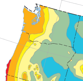
Washington faces the second highest risk from earthquakes, and one of the highest for tsunamis in the nation, yet remains the only west coast state that does not have an inventory of the seismic hazard for critical infrastructure. In addition, many communities along the coast have either outdated tsunami inundation maps – or no maps at all.
 That’s why DNR is asking the legislature this year for a funding package that will allow us to produce a robust set of tsunami inundation maps; inventory critical infrastructure; provide maps and data for emergency responders, city planners and our fellow geologists; and – most importantly – identify, map and mark evacuation routes in communities that might impacted by the next tsunami, whether that’s from a Cascadia subduction event or more remote earthquakes like this week’s M7.9 strike slip quake at the convergence of the Pacific and North American plates southeast of Alaska’s Kodiak Island.
You can find out more about the risks Washington’s active geology present to you and your loved ones with the scenario catalog or by the hundreds of reports on Washington geology filed in the Washington Geology Library. Those reports can also be accessed online through our new publications catalog.
For more tips on how to be best prepared for the next disaster, check with Washington’s Emergency Management Division.
